Weather · iPhone and iPad
FullSky - 3D Weather Radar
By Create Modern · Requires iOS 26 or later
Orbit and analyze the weather in 3D, and slice straight through it to find features such as the hail core or signs of rotation associated with tornadoes — for live and historic storms, locally or across the U.S.
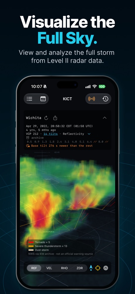
Visualize the Full Sky. View and analyze the full storm from Level II radar data. 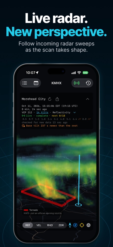
Live radar. New perspective. Follow incoming radar sweeps as the scan takes shape. 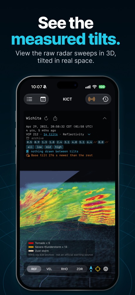
See the measured tilts. View the raw radar sweeps in 3D, tilted in real space. 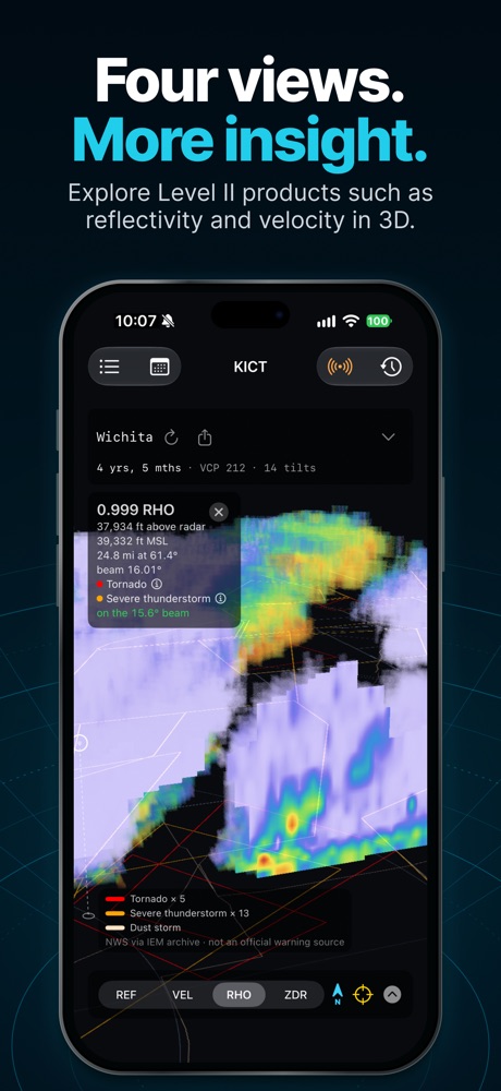
Four views. More insight. Explore Level II products such as reflectivity and velocity in 3D. 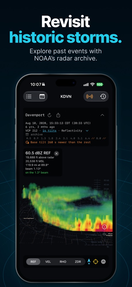
Revisit historic storms. Explore past events with NOAA’s radar archive. 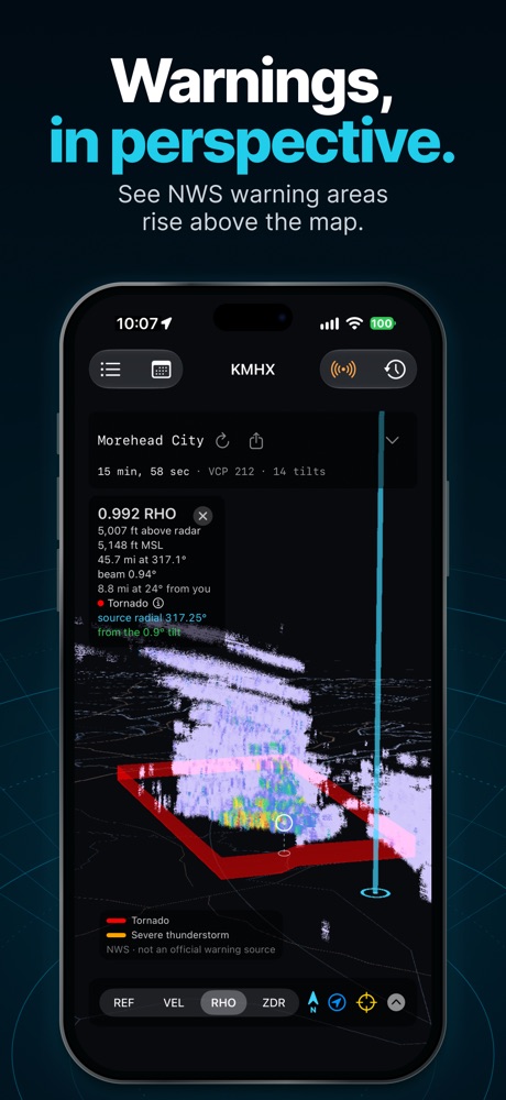
Warnings, in perspective. See NWS warning areas rise above the map.
Features
See the weather in full 3D.
Live and historic storms
- Live high-resolution Level II radar from every available U.S. NEXRAD site, updated tilt by tilt as the radar scans
- Explore the NOAA archive for any day of the year: pick a radar and a date to study historic storms and their signatures
- Loop and scrub through recent or past scans
See inside the storm
- Reflectivity, velocity, correlation coefficient, and differential reflectivity — for rain, rotation, hail, and debris
- Level cuts at any height, plus north–south and east–west slices through the full volume
- Tap anywhere to read the measured value at that point
Warnings in 3D
- National Weather Service tornado and severe thunderstorm warnings stand as curtains over the warned area
- View the full warning text for an area with a touch
- Warnings are included for historic storms, too
Share what you see
- Save a screenshot, an orbiting video, or a time-lapse
- Every export carries a footer naming the radar, the time, the data source, and how it was drawn
Made for the field and the classroom
- Finds your nearest radar automatically, or pick one by region, state, or search
- Can follow you from radar to radar as you travel
- Built-in offline base map, with Apple Maps road and satellite views as options
Learn how radar works
- Visualize the radar beam and the cone of silence to understand how NEXRAD works
- Smooth view draws one continuous storm; tilts view draws exactly what the radar measured, at its true angles
- Simple visuals for range, cities, and towns show where the weather is happening
iPad
Even more sky on iPad.
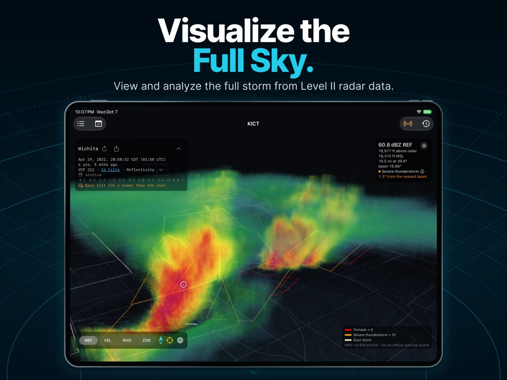
Visualize the Full Sky. View and analyze the full storm from Level II radar data. 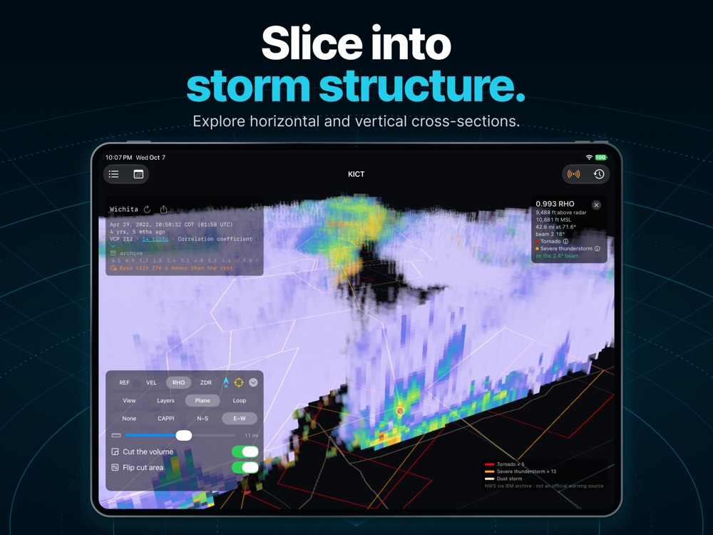
Slice into storm structure. Explore horizontal and vertical cross-sections. 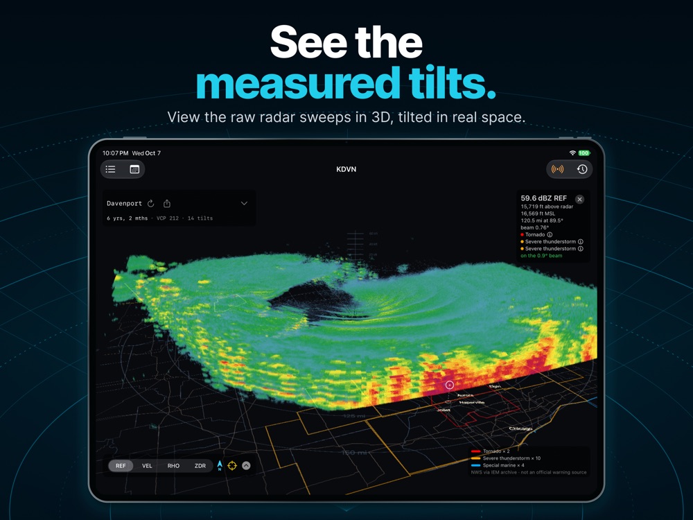
See the measured tilts. View the raw radar sweeps in 3D, tilted in real space. 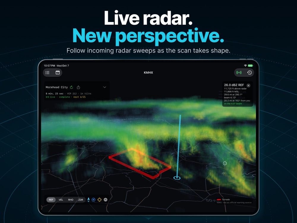
Live radar. New perspective. Follow incoming radar sweeps as the scan takes shape. 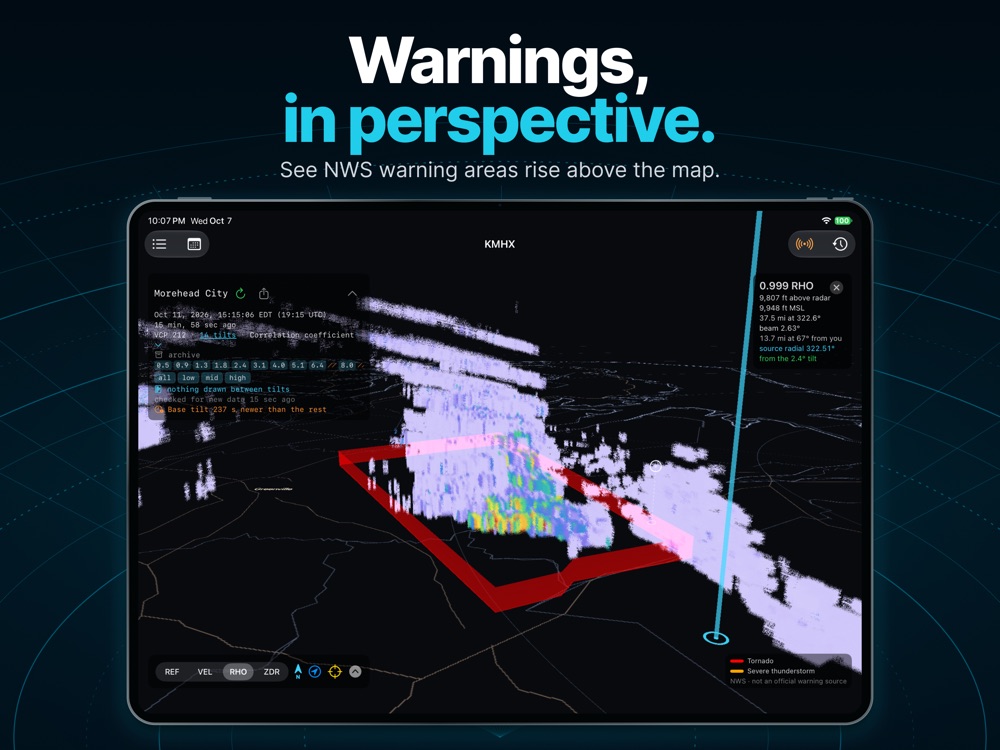
Warnings, in perspective. See NWS warning areas rise above the map. 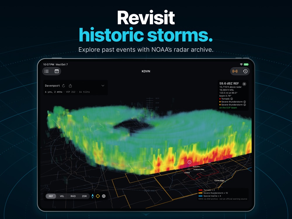
Revisit historic storms. Explore past events with NOAA’s radar archive.
Details
Good to know.
iPhone and iPadRequires iOS 26 or later
U.S. NEXRAD coverageData from functioning National Weather Service radar sites; an internet connection is needed to download it
No account neededNo ads, no tracking, and your location stays on your device
FullSky is built for learning and exploring complex radar products in a simple way. During severe weather, always follow the National Weather Service and your local officials.
View on the App Store (opens in a new tab)
Need help or have an idea? Contact FullSky support.